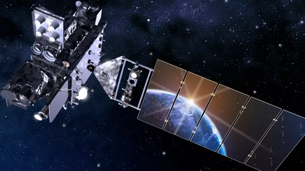
The National Oceanic and Atmospheric Administration's (NOAA) GOES-19, the final satellite in the GOES-R series, has officially commenced operations as GOES East on April 7, 2025. This marks a significant advancement in weather and space weather monitoring capabilities for the Western Hemisphere. Launched on June 25, 2024, GOES-19 underwent thorough post-launch testing of its instruments and systems before taking over from GOES-16, which now serves as an on-orbit backup. Positioned 22,236 miles above the equator at 75.2 degrees west longitude, GOES-19 provides critical data to forecasters, enhancing their ability to predict and analyze weather and space weather events.
GOES-19 is equipped with advanced technology to deliver high-resolution visible and infrared imagery, atmospheric measurements, and real-time mapping of lightning activity. A key instrument onboard is the Advanced Baseline Imager (ABI) from L3Harris Technologies, which rapidly and accurately detects and tracks hazards such as severe thunderstorms, wildfires, and hurricanes. The ABI monitors weather conditions and collects data that provides meteorologists with accurate, real-time information.
One of the most exciting features of GOES-19 is its compact coronagraph instrument (CCOR-1), NOAA's first, which monitors the sun's activity. CCOR-1 images the solar corona, the outer layer of the sun’s atmosphere, to detect solar storms and coronal mass ejections. This is a game-changer for ensuring national resilience to solar storms, offering up to three days' notice of potential space weather events that could impact satellites, GPS, astronaut safety, aviation, and power grids.
GOES-19 plays a vital role in tracking hurricanes and tropical storms in the Atlantic Ocean basin, as well as monitoring severe weather, atmospheric rivers, wildfires, volcanic eruptions, and other environmental events affecting the contiguous U.S. The data from GOES-19 allows for faster and more reliable forecasts, contributing to the safety and security of communities.
The GOES-R series represents a major advancement in geostationary weather satellites. These satellites provide advanced imaging with increased spatial resolution and faster coverage for more accurate forecasts, real-time mapping of lightning activity, and improved monitoring of solar activity. With the full GOES-R fleet now in orbit, NOAA has the most sophisticated technology ever flown in space to help forecast weather on Earth and monitor space weather events.
The GOES-19 mission exemplifies NOAA's commitment to providing secure and timely access to global environmental data and information, protecting the nation's security, environment, economy, and quality of life. The satellite’s advanced capabilities ensure that forecasters have the tools they need to predict and analyze weather and space weather conditions, helping them make critical decisions to save lives and property. The success of GOES-19 marks a significant milestone in weather and space weather monitoring, paving the way for future advancements in satellite technology and forecasting accuracy.


